

Brevard Fault Zone
Running southwest-northeast across Alabama, Georgia, and North Carolina, the Brevard Fault Zone (or the Brevard Zone of Cataclasis) is a prominent geologic feature of the Southeast United States.
Geologists continue to debate the Brevard's structure and significance, and the nature and direction of ancient movement on the fault. The Brevard has been interpreted as a left-lateral strike-slip fault, a right-lateral strike-slip fault, a normal fault, or a thrust fault. At one time, it was thought to represent the suture where Proto-Africa joined Proto-North America to form Pangea, although rocks on one side of the fault generally resemble those on the other side. Structural clues to movement are ambiguous; however, the "smeared" shapes of some granite bodies suggest right-lateral movement. The fault -- fortunately for us -- last moved about 185 million years ago, so the question is not of practical urgency.
Rocks in the Brevard zone are profoundly sheared and fractured; they include mylonites, button schists, and gneisses. In many segments, Brevard Zone topography features rhythmically-spaced parallel ridges, which control much of the Chattahoochee Rivers course.
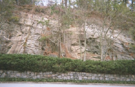
Long Island gneiss
IBM entrance
U.S. 41 north of Mount Paran Road,
Atlanta, Georgia
----------------------------------------------------
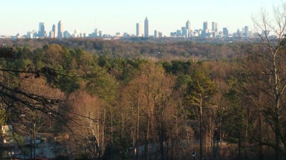
Parallel Ridges in the Brevard Zone
Vinings, Georgia
Vinings, Georgia
On a shaded-relief map, many segments of the Brevard Zone show rhythmically-spaced parallel ridges, oriented along the Zone's northeast strike. These ridges are responsible for the Chattahoochee River's northeast-to-southwest course through north Georgia; they intercept drainage that would otherwise flow southeast toward the Atlantic Ocean, diverting it southwest toward the Gulf of Mexico. In northwest Atlanta, the Chattahoochee breaks through these ridges, probably by following sets of joints (fractures) in the ridge rock.
The Gold Belt and the Murphy Belt show similar sets of parallel ridges, suggesting structural similarity among these features.
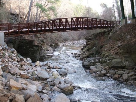
Rottenwood Creek
Chattahoochee River National Recreation Area
Atlanta, Georgia
Chattahoochee River National Recreation Area
Atlanta, Georgia
Traversing the fringes of the Chattahoochee River National Recreation Area (CRNRA), Rottenwood Creek receives an unpleasant amount of trash and runoff from office and retail establishments around Cumberland Mall, before emptying into the Chattahoochee. Recent development has actually improved the environment of this segment of the creek, if you can ignore the sounds of traffic.
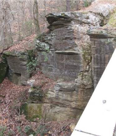
A bridge beneath a bridge
Bicycle/foot trail crosses Rottenwood Creek
as it enters CRNRA below the Cumberland Boulevard bridge.
See below for detail of joints on left bank.
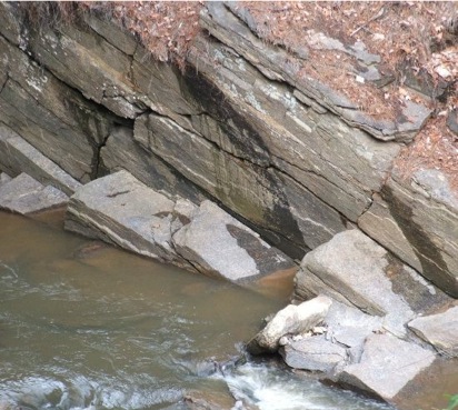
Vertical joint face on left
bank below bridge.
Typical of the Brevard
Zone, structure dips
southeast (e.g. dipping
joints and elongated
lenses.)
More vertical joints alongside
trail. These joint faces are
parallel to strike; intersecting
joints are perpendicular to
strike.